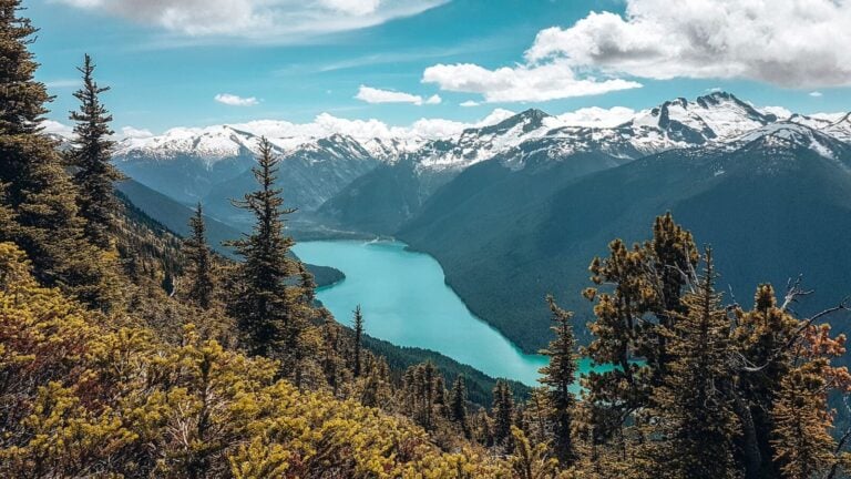

We lived in Whistler, about an hour from Joffre Lakes, so we thought it was about time we found out for ourselves whether the stories about the colour were true.
Joffre Lakes is one of the most popular hikes in British Columbia. 3 lakes connected by 1 trail, each a more striking shade of turquoise than the last.

Below, we’ll take you through the trail: Lower, Middle and Upper Joffre Lake, the campsite and Matier Glacier, then cover everything else you need to know, including the permit system, which has changed significantly since we last hiked here.

3.5 to 4.5 hours for the 9.5km round trip to Upper Joffre Lake. This allows for time to actually enjoy it rather than rush.
Roughly 5 minutes to Lower Joffre Lake, 1 hour to Middle Joffre Lake, and another 15 minutes to Upper Joffre Lake. Add an extra hour each way if you’re hiking up to Matier Glacier too.

We set off late afternoon, as camping meant we didn’t need to allow time to hike back down in daylight.
From the car park, Lower Joffre Lake is about 5 minutes in, and we could immediately see that the stories about the colour were true.

Matier Glacier is visible from here too, looming above where the campsite sits. This lake is very popular with families since it’s a flat 5-minute walk from the car park, though the climb on to Middle Joffre Lake isn’t recommended for small children.
Our top tip: we only set off late afternoon because we were camping. If you’re doing this as a day hike, get here as early as possible, as it gets very busy.
Head back to the junction and turn left. The trail to Middle Joffre Lake is steep, around 1 hour, and will get your heart pounding.
The path starts flat along the lakeshore, crosses a wooden bridge, then begins to climb. It’s well-maintained but rocky in places.
For about 30 minutes, you’re in tree shade; worth appreciating if you’re carrying camping gear on a hot afternoon. After that, a clearing opens up with views back across the U-shaped valley, then steep switchbacks take you back into the woods.
Look back for views of Lower Joffre Lake and Cayoosh Mountain across the valley.

The path levels out, and Middle Joffre Lake’s blue starts showing through the trees. There’s a viewpoint with somewhere to sit and take in Matier Glacier in the distance, then follow the shoreline a minute further to the floating log that everyone photographs.

Unless you’re here super early, be prepared to queue for photos. Almost everyone who does this hike wants this photo, so you may have to wait a while.
Our Top Tip: if you’re camping, don’t bother queuing. Get up early for the photo before the day hikers arrive.
If you’re feeling brave, dive in. However, the lake is glacial, so it’s absolutely freezing. There are also benches on the trail next to the lake where you can sit and enjoy the view.
Upper Joffre Lake is around 15 minutes further on from here.
The trail continues around the lake and into the trees. Climbing slightly past Holloway Falls, up a short set of stairs, then flattening out across a bridge and boardwalks.

Stay on the main trail as it’s marshy, and going off-trail damages the environment. At the junction, turn left for Upper Joffre Lake Viewpoint, scramble over the rocks, and you’ll reach the lakeshore.

You can see Matier Glacier hanging above on Slalok Mountain; Joffre Peak is on the left.

The campsite sits on the far side of Upper Joffre Lake, beneath Matier Glacier. We’d recommend the walk over even if you’re not camping, as it’s quieter and away from the crowds.

The path gets much more rugged, with some scrambling over boulders and roots.
It’ll take around 20-30 minutes to reach Joffre Lakes Campsite, and this is where the official Joffre Lakes Trail ends.
Once the sun sets, it gets cold fast, so bring warm layers if you’re staying.
The lake also completely changes colour once the sun isn’t shining on it, which is kinda crazy.

We’d lost our tent cover, so we hoped it wouldn’t rain. Luckily, it didn’t, and what was a complete surprise- and what we wouldn’t have seen if we did have the tent cover- was the stars.
Neither of us had seen a shooting star before, and here we were lying in bed with them whizzing through the sky literally every few seconds! It was totally mesmerising and a really incredible experience.
So make time to sit outside once it’s completely dark, or leave your tent cover off, and you might get the same. Mother Nature is truly amazing sometimes.
The following morning, we were up at 7am and headed straight to Middle Joffre Lake for the iconic log shot without the crowds.
You’ll need a backcountry reservation booked in advance through BC Parks to camp here.

We went back to the tent, had some breakfast and tried to figure out if we could hike up to Matier Glacier.
There isn’t an official trail, but you can see a faint path where people have hiked up before, so we followed that. It’s a real scramble and quite challenging, but definitely worth it.

It’ll take about an hour to reach the glacier, and from here, you get the only view where all 3 Joffre Lakes line up together below, with Cayoosh Mountain rising dramatically behind them.


Take some time to enjoy the view up here, then head back to the campsite the way you came.
Joffre Lakes Provincial Park is near Pemberton in British Columbia. It’s about an hour north of Whistler and 2.5-3 hours from Vancouver, just off the Sea to Sky Highway.
The park’s official name is Pipi7íyekw/Joffre Lakes Provincial Park, unceded traditional territory of the Lil’wat Nation and N’Quatqua, who continue to hold ceremonies there today.
By car: it’s 62km from Whistler, north on the Sea to Sky Highway (Highway 99). Continue towards Mount Currie, and turn right at the intersection towards Lillooet. About 20km on, you’ll see signs for the car park.
From Vancouver, it’s 182km north on the Sea to Sky Highway through Squamish, Whistler and Pemberton.
Can you drive to Joffre Lakes? Yes, and it’s the easiest way. There’s a free car park with an overflow lot across the road. Your day-use pass gets you onto the trail, but doesn’t guarantee a spot in the car park, so it’s worth arriving as early as possible if you’re doing a day trip. If you’re camping, you can arrive later once the day-trippers have left.
Without a car: there’s no public transport to Joffre Lakes, but there are a few options. You can book a rideshare through Poparide, try hitchhiking (though be careful), or your most reliable option is to book a guided day trip, which includes transport from Whistler.
You’ll need a free Joffre Lakes day pass to hike between May 11 and October 25, 2026, and unlike some BC parks, everyone in your group needs their own pass, not one per vehicle. Passes are released online at 7am, 2 days before your visit, and they go fast. Some summer weekends have sold out within seconds. Print or screenshot it before you set off, as there’s no cell service at the trailhead to pull it up from your email.
If you’re camping overnight, your backcountry reservation covers you; you don’t need a separate day pass.
If you’ve searched for Joffre Lakes Provincial Park tickets, there isn’t one to buy. It’s the free day-use pass above that gets you onto the trail, not a paid ticket.
The park now completely closes on 2 occasions in 2026. June 20-27 and September 8-30, to allow the Lil’wat Nation and N’Quatqua time on the land. No passes are issued during these dates.
Camping is no longer first-come, first-served. You’ll need to book Upper Joffre Lake Campground in advance through BC Parks’ reservation system, which opens on a 3-month rolling window. Reservations are required year-round, and book as early as you can, especially for summer weekends.
Roughly 400m from the car park to Upper Joffre Lake, and another 380m if you continue up to Matier Glacier.
June to September for the best weather and the most vivid blue. October brings fewer crowds and golden larches, but trails can be icy, and it’s too cold to comfortably camp. Winter turns this into a popular snowshoe route, but there’s a real avalanche risk, so only do it if you have the experience and equipment.

Intermediate. The most strenuous section is between the first and middle lakes, but the path is well-maintained, and there are plenty of areas to take a break.
Yes, though it’s genuinely cold, glacier meltwater year-round. Middle Joffre Lake, where the floating log is, is the most popular spot to swim. Usually it’s just people jumping off the log rather than properly swimming.
Pemberton is the closest town, about 20 minutes from the trailhead, or Whistler if you’d rather have more choice of places to eat and stay. I’d recommend The Listel Hotel in Whistler. I (Helen) actually worked there for a year and would happily stay; it’s a great base right in the Village.
If you’re driving up from Vancouver for a day hike, staying the night before means you’re not setting off at 4am to make the most of the day.
No.
There are toilets at the trailhead, Middle Joffre Lake, Upper Joffre Lake and the campsite. Bring your own toilet paper.
We hope this helps you plan your own trip to hike Joffre Lakes. Drop us a comment if you’ve got any questions; we’re always happy to help.
Looking for more Canada inspiration? Check out our other Canada guides below for everything you need.
And come find us on Instagram for real-time updates, behind-the-scenes chaos and more travel tips and inspiration 😊