
Whistler will always hold a special place in our hearts. It’s where we met and got to know each other by hiking and camping in these mountains. One of our favourite early-days memories is camping at Joffre Lakes. We’d lost the tent cover, so thankfully it didn’t rain, and as we lay in bed, we watched shooting stars whizz past literally every few seconds for hours. It was such a magical experience and one we still talk about to this day.
Hiking around Whistler, you can expect turquoise glacial lakes, granite peaks, never-ending ridgelines, and glaciers close enough to touch. Meadows are carpeted in wildflowers, and scree fields test your legs as you hike up to some of the best views in British Columbia.
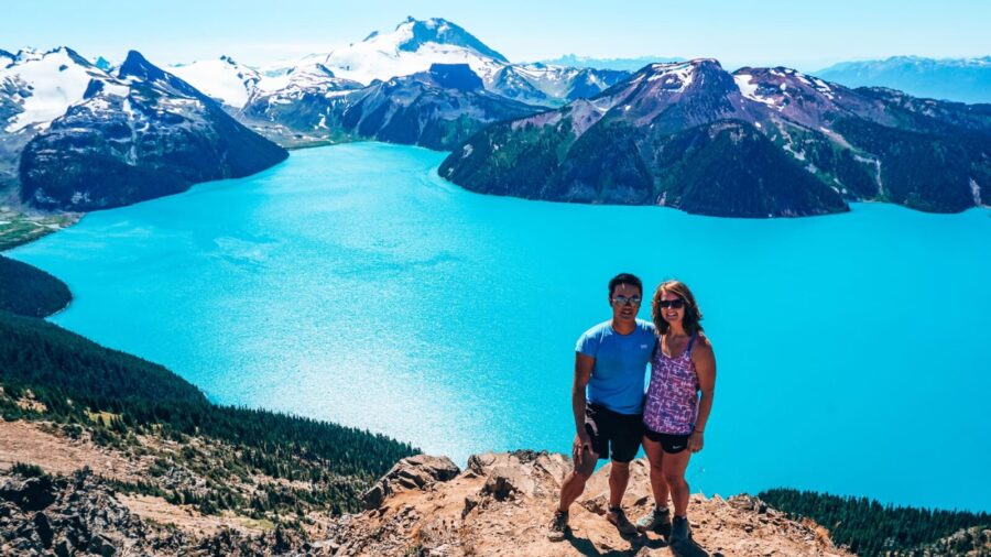
There are so many hikes around Whistler that it can be quite overwhelming trying to decide which to prioritise. As we both lived there- Andy for 2 years, me for 1- we managed to tick off a lot, so we’ve rounded up our favourites.
Some of them are hikes near Whistler Village that, ideally, you’d have a car for (there are options if you don’t have a car, though, don’t worry). Joffre Lakes is the furthest, at 1 hour from the village, and one starts right from the Whistler Village Gondola.
In this guide, we share our 8 favourites, ordered roughly by how much effort each takes, so pick based on what kind of day you’re after. We then share everything you need to know before hiking in Whistler, including permits and day passes, the best time for hiking around Whistler, and whether it’s safe to hike in bear country.
Hiking trails in Whistler are spread across a wide area. Some start right in the village; others you’ll need to drive to.
Below is a map of where the 8 hikes are, so you can see which are close by and which need more planning.
Whistler hiking ranges from the moderate, gondola-assisted High Note Trail to much more challenging routes like Panorama Ridge and Black Tusk in Garibaldi Provincial Park. Joffre Lakes and Rainbow Lake sit in the middle, both rewarding without needing a full day’s effort.
Whichever you pick, expect turquoise lakes, glaciers and endless mountain views.
Here’s the full breakdown of each one, starting with the easiest, in our opinion.
Wrapping around the back of Whistler Mountain, the High Note Trail gives you some of the best views of Garibaldi Provincial Park you’ll get anywhere, with Black Tusk dominating the skyline the entire way.
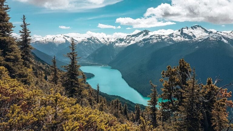
The real highlight is Cheakamus Lake, a piercing blue glacial lake far below you as you make your way along the ridge, with mountain peaks towering above it.
Most of the trail is downhill, since it starts at the very top of the mountain. You’ll pass through alpine meadows, often full of wildflowers in early August, and over rocky, uneven ground with some scrambling over boulders.
Near the end, you’ll drop past Symphony and Harmony Lakes before one final uphill push back towards the gondola. Quite the struggle after all the downhill.
The trail is usually free of snow from late June through to October.
Length: 9.5km
Rating: Moderate
Elevation gain: Around 400m
Location: Whistler Mountain Peak
To reach the start, you’ll need a Summer Sightseeing Pass for the gondola up, which also gets you onto the Peak 2 Peak and both mountains. You can technically hike up instead of paying for the pass, but it’s a serious hike. It’s around 16km from Whistler Village just to get to the peak of Whistler Mountain before you’ve even started the High Note Trail. Not something we’d recommend doing.
If you’d rather hike right to the shore of Cheakamus Lake instead of just admiring it from above, a guided hike takes you there directly.

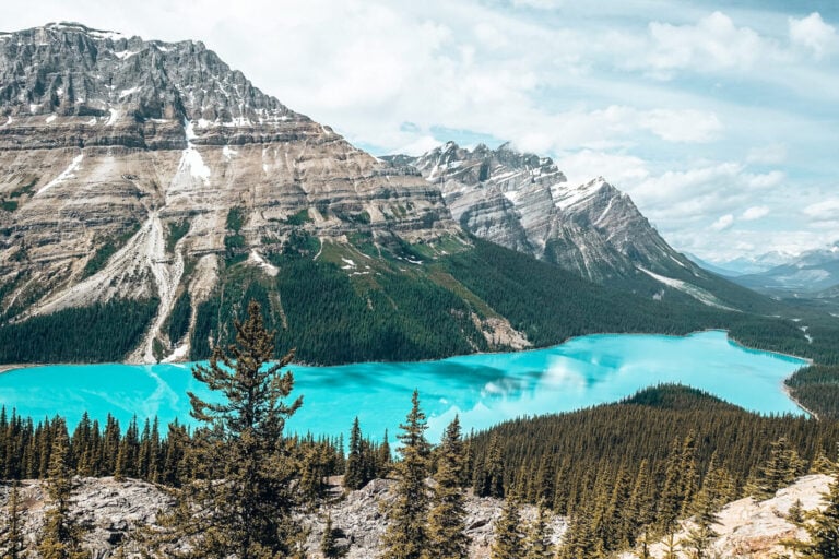
Joffre Lakes are a group of 3 striking blue glacial lakes with Matier Glacier looming above them, and one of the most popular hikes near Whistler for good reason.
It’s relatively short but steep, though there are plenty of places to stop for a break, with sweeping views across the valley.
The first lake is a 5-minute walk from the car park. Looking up from here, you’ll get your first proper glimpse of Matier Glacier towering in the mountains above.
Middle Joffre Lake, about an hour further on, is the one everyone comes for. The spot with the floating log and glacier backdrop that ends up on every Instagram feed. Be prepared to queue for a photo.
Our top tip: if you’re camping overnight (see our full Joffre Lakes hiking guide), don’t bother queuing. Get up early for photos before the day hikers arrive.

Upper Joffre Lake is another 15 minutes on through the trees, past a waterfall. The campsite sits on the far side, and even if you’re not staying the night, it’s worth heading over as it’s much quieter.
For the best view, scramble up to Matier Glacier. There’s no official trail, but it’s the only spot where you can see all 3 lakes lined up below you. You can see where other people hiked, so it’s easy to follow.

Length: 10km round trip to Upper Joffre Lake
Rating: Moderate, just because it’s quite steep, but if you’re looking for easy hikes in Whistler, this is a good one.
Elevation gain: 400m
Location: Sea to Sky Highway, 30km north of Pemberton.
Everyone hiking will need a free day-use pass, which can be booked online. Print or screenshot it, as you’ll need to show it at the trailhead and there’s no phone signal.
A guided day trip covers the same route with transport included from Vancouver or Whistler.
Stawamus Chief is one of the best hikes near Whistler, in Squamish, and a great stop on the Sea to Sky Highway if you’re driving to/from Vancouver.
As you drive into Squamish, you can’t miss it. It’s one of the largest granite monoliths in North America, towering right above the town. There are 3 distinct peaks, all reachable from the same track, so you don’t have to summit all 3 if you’re short on time.
If you’re doing the full hike, start with the Third Peak. It’s the highest, and since most people stop after the first, it’s also the quietest. Between Third and Second Peak, you’ll cross North Gully, where the trees open up to a view straight over Squamish and Mount Garibaldi.
First Peak has the best views over Howe Sound, and being closest to the car park, it’s also the busiest.
Our top tip: all 3 peaks have plenty of ledges and drop-offs, so watch your footing, especially near the edges.

Length: 11km round trip
Rating: Moderate
Elevation gain: ranges from 540m to 630m depending on which peaks you hike to
Location: off the Sea to Sky Highway, just south of Squamish if you’re driving to Vancouver
Rainbow Lake is one of the most easily accessible hikes in Whistler, with the trailhead sitting on the opposite side of Alta Lake from the village.
The trail climbs gradually, winding its way through lush forest, past trickling streams and waterfalls, and across creek bridges, until the trees finally open out onto Rainbow Lake, tucked into its own alpine valley.
For the best view, keep going round to the far side of the lake. From there, you can see Wedge and Blackcomb Mountains and, on a really clear day, Black Tusk too.

Length: 16km round trip
Rating: Moderate
Elevation gain: around 870m
Location: Alta Lake Road, 15 minutes from Whistler Village
Our top tip: as tempting as it looks to swim in Rainbow Lake, especially on a hot day, please don’t. It’s a source of drinking water for Whistler Village, so there’s no swimming or camping allowed.

Garibaldi Provincial Park is home to some of the best hiking in Whistler; a few of the hikes on this list you’ll find here.
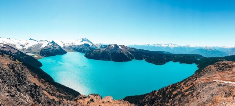
Garibaldi Lake is one of the most beautiful lakes in British Columbia, and worth the trip to its shores. If you go on to do Panorama Ridge, you’ll get an even better view of it from above, but it’s just as striking down at the water.
Most of the hike is switchbacks through the forest for 6km. Fairly uneventful, but it’s shaded from the sun at least. In the final 3km, the hike becomes more rugged, scrambling over roots and branches as you pass The Barrier, an old lava dam holding back the lake system, and Lesser Garibaldi Lake; a little teaser of what’s to come.

A few more switchbacks and a steep dirt slope bring you down to a small wooden bridge. Cross it, and the lake opens up in front of you. Snow-capped mountains on one side, Sphinx Glacier looming behind it on the other.
The lake is glacially fed, but it’s a great place for a dip to cool down, especially if you’re camping and want to feel fresh before bed.
Sunset over Garibaldi Lake and Sphinx Glacier is honestly so magical. You feel a world away from anywhere, watching the sun light up the glacier in a fiery red glow.

Length: 18km round trip
Rating: Moderate
Elevation gain: 820m
Location: Rubble Creek trailhead, 25km south of Whistler
For everything you need to know about hiking in Garibaldi Provincial Park, check out our full guide.
One of the toughest hikes on this list. You’ll gain over 1,100m of elevation in just 6km, meandering uphill and scrambling over roots and large rocks the whole way, though you’ll be in the shade of the forest at least.
There are plenty of amazing viewpoints over the neighbouring mountains along the way if you need a break.
Once you finally come out at Wedgemount Lake, you’ll understand why you put yourself through it. The lake’s piercing turquoise colour is perfectly offset by the surrounding dark, imposing snow-capped granite peaks.
From up here, you’ll be rewarded with incredible views over the surrounding mountains, including Rethel Mountain, Parkhurst Mountain and Mount Cook.

Our top tip: if you’ve got any energy left, carry on to the far side of the lake for a full view of Wedgemount Glacier.
Length: 14km round trip
Rating: Difficult
Elevation gain: around 1,200m
Location: Sea to Sky Highway north, past Green Lake and turn right onto Gravel Pit Road
Black Tusk is an extinct volcano in Garibaldi Provincial Park, its jagged black rock rising up out of the surrounding mountains like something out of another world.
The trail leading to it winds through colourful wildflower meadows and shaded forest, with Garibaldi Lake visible below through the trees for much of the way.
Near the top, the landscape shifts entirely. Loose, exposed scree, the result of thousands of years of erosion wearing away at the old volcano. It’s really quite challenging to hike up, but at least the views of Garibaldi Lake from up here are worth the breaks.

Length: 30km round trip
Rating: Difficult
Elevation gain: 1,740m
Location: Rubble Creek trailhead, 25km south of Whistler

We’re finishing this guide with what was, for us, the absolute best hike in Whistler. The route starts the same as Black Tusk with wildflower meadows and alpine forest, before opening up into steep, exposed rockfall near the summit.
At the top, Garibaldi Lake sits below you, with that astonishing turquoise colour and Sphinx Glacier towering above it. Behind you, Black Tusk soars over Black Tusk and Helm Lakes.

It’s one of the most striking views in British Columbia, and one that has to be seen to be believed.
Length: 30km round trip
Rating: Difficult
Elevation gain: 1,520m
Location: Rubble Creek trailhead, 25km south of Whistler
Our top tip: combine this with Black Tusk and an overnight camp at Garibaldi Lake. Splitting it over 2 days is far easier than trying all 3 in 1 go. Check out our full guide for everything you need to know about hiking in Garibaldi Provincial Park if this sounds up your street.
As with Joffre Lakes, you’ll need to reserve a free day-use pass online to hike in the park.
A guided day trip is also available if you’d rather do Panorama Ridge in a day, with a guide handling all of the logistics, including your day pass.
Whistler Village puts you closest to most of these hikes. They’re either a short drive away, or you can start straight from the village. Joffre Lakes is an hour’s drive, and that’s the furthest.
We’d recommend the Listel Hotel; I (Helen) actually worked there and would happily stay there. It’s a great base for a few days, just off the village, which is perfect as it can get quite noisy at night. But you’re less than a minute’s walk away.
If you’d prefer something more luxurious, the Westin Resort & Spa next door is a great option with lovely mountain views.
Whistler is black bear and grizzly bear territory, although grizzlies are very rarely seen. Carry bear spray somewhere accessible, not buried in your bag, and make noise as you walk.
It’s unlikely you’ll see a bear, even a black bear. They share their home with millions of visitors, so they’re used to seeing people and would prefer to keep their distance.
If you do see one, stay calm, speak firmly so it can identify you as human, and back away slowly rather than running.
June to September, once most trails have cleared of snow. Higher-elevation hikes like Black Tusk and Panorama Ridge can still be snowy until August, so check conditions before you set off.
All of the trails are free to hike, though you need to book a day-use pass for Joffre Lakes and any of the hikes in Garibaldi Provincial Park, except Wedgemount Lake.
There’s a fee if you’re camping overnight, and reservations need to be made online in advance. You don’t need a day-use pass on top of your camping reservation.
For Whistler Mountain hikes, you’ll need a Summer Sightseeing Pass for the gondolas, unless you plan on hiking up.
High Note Trail. A gondola takes you to the start, and it’s pretty much all downhill, except at the end. It’s still rated as moderate because parts are rocky and uneven.
Yes, for Whistler Mountain. The route starts in Whistler Village and follows Singing Pass Trail, connecting through Musical Bumps and finishing on the High Note Trail. It’ll be a very long day, between 22 and 27km and between 9 and 11 hours depending on pace.
Blackcomb is different. The Ascent Trail climbs roughly 1,200m over 6km from the base to the restaurant, Rendezvous, but that’s not the summit. Reaching the summit is a technical mountaineering scramble, not a hike, so it’s not something to attempt without the right experience and gear.
Rather see Blackcomb’s terrain without the climb? A helicopter tour covers the same mountains from above, no scrambling required.
We hope this helps you plan your Whistler hiking trips. If you’ve got any questions, drop us a comment below, and check out our other Canada guides while you’re here.
And come find us on Instagram for real-time updates, behind-the-scenes chaos and more travel tips and inspiration 😊